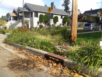
Typical streets are directly connected impervious areas because they are built to drain into catch basins and pipes that send runoff away without any opportunities for evaporation. On Woodland Drive at Clark Park, the City of Vancouver has built a perforated curb that allows for runoff to flow into a rain garden, where it has the opportunity to infiltrate or evapotranspire.
The traditional way cities manage stormwater is by collecting it from impervious surface such as pavement and buildings and to carry it quickly into pipes to a nearby stream, or, when mixed with sewers, to a water treatment plant. This grey system poses problems mainly at two levels: water quantity, and water quality. From the quantity standpoint, the problems are created by landscape that do not allow for stormwater to infiltrate to evapotranspire. This increases surface runoff and creates problems such as erosion of streams, or even combined sewer overflow where raw sewage is spilled directly into our waterways. Water quality is an issue because of all the pollutants that stormwater collects in our cities, which have no opportunity to be filtered by plants and soil before being carried to the natural water system.
This project was realized as a partnership between the Water Planning Lab and Diamond Head Consulting, funded by the Mitacs program. The goal of this research was to better understand the role of the urban forest – trees and plants present throughout urban landscapes – for stormwater management. In particular, I wanted to better understand how the presence or absence of trees and plants affect both stormwater runoff quantity and quality. This was made possible with the use of the stormwater modeling software i-Tree Hydro, from the USDA Forest Services. The free tool enables “urban planners [to] quantify the impacts of changes in tree and impervious cover on local hydrology to aid in management and planning decisions.”
I used a small, single-family residential area in Vancouver’s Hasting-Sunrise as a case study. I tested both the impact of tree canopy and soil cover (pervious or impervious), as well as scenarios of the evolution of the area.
My results indicate that changes in impervious cover have an impact eleven times higher than changes in canopy cover on surface runoff. My scenarios show that the biggest factor affecting stormwater runoff quantity and quality is directly connected impervious areas (impervious areas that drain directly into a stream or a pipe). However, the substantial decrease also results in an increase in pervious flow (saturated soils). Increases in tree canopy have a significant impact on the reduction of pervious flow.
Overall, I found that the most effective change for stormwater management policies in Vancouver would be to reduce directly connected impervious areas. Policies recommending a reduction of these surfaces should also enhance the urban forest and consider engineered green infrastructure solutions to allow for sufficient infiltration and evapotranspiration. For trees to be most efficient contributors to stormwater management (and more healthy!), more pervious soil should be retained or restore at their base.
Tools such as i-Tree Hydro require a significant time investment, but can offer key information for planners and decision-makers to inform decisions on the contribution of the urban forest and other surface covers to stormwater management.
You are able to check the full project on UBC Circle.
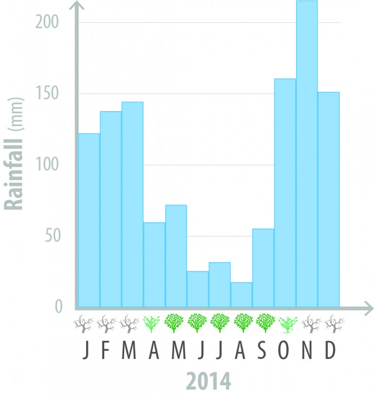
Vancouver receives most of its precipitation during the winter, fall and spring months. This limits the interception capacity of urban deciduous trees, which have no leaves on at that time of the year.
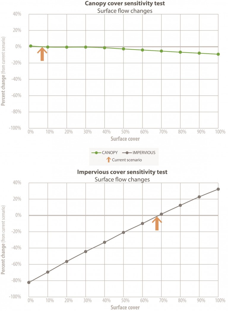
As shown on the two graphs, equivalent changes in tree canopy and pervious/impervious soil cover yield highly different changes in surface runoff quantity changes. The soil cover has an 11 times higher impact on runoff quantity. However, in a realistic setting tree planting is likely to be accompanied by an increase in pervious cover at its base, therefore combining the impacts of the canopy and soil cover.